Identity area
Reference code
1Fi13
Title
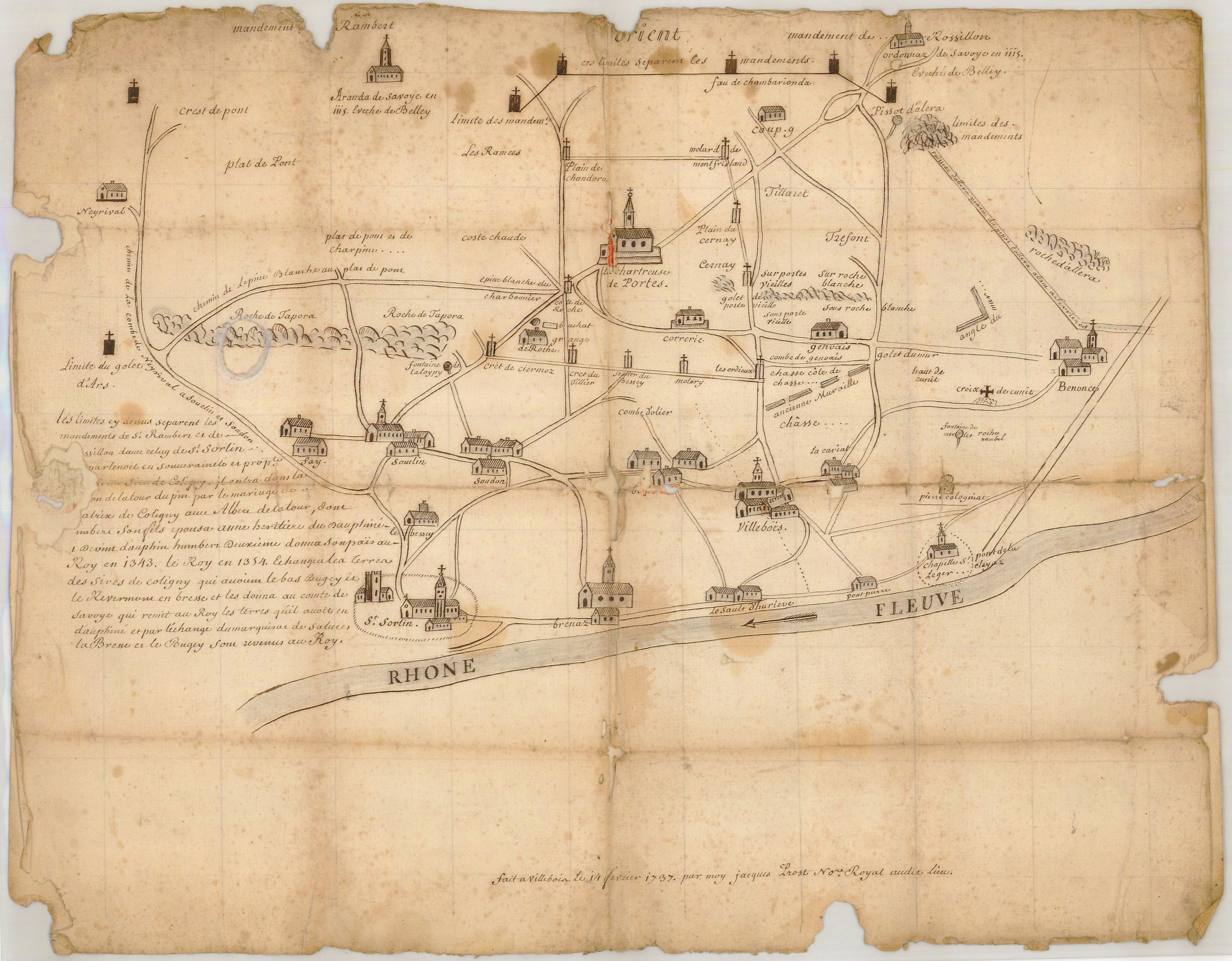
Plan des limites des mandements de Saint-Rambert et Rossillon avec celui de Saint-Sorlin qui appartenait en l’an 1115 au sire de Coligny.
Date(s)
- 1737 (Creation)
Level of description
Item
Extent and medium
1 plan de 53x41 cm
Context area
Name of creator
(1790/2099)
Repository
Archival history
Immediate source of acquisition or transfer
Content and structure area
Scope and content
Appraisal, destruction and scheduling
Accruals
System of arrangement
Conditions of access and use area
Conditions governing access
Conditions governing reproduction
Language of material
Script of material
Language and script notes
Physical characteristics and technical requirements
Finding aids
Allied materials area
Existence and location of originals
Existence and location of copies
Related units of description
Notes area
Note
1115 correspond à la date de fondation de la Chartreuse de Portes.
Alternative identifier(s)
Access points
Subject access points
Place access points
- Ain (Rhône-Alpes, France ; département) » Bénonces (Ain, France) » Portes, Chartreuse de (Bénonces, Ain, France ; jusqu'en 1791)
- Ain (Rhône-Alpes, France ; département) » Rossillon, Mandement de (Ain, France ; jusqu'en 1789)
- Ain (Rhône-Alpes, France ; département) » Saint-Rambert, Mandement de (Ain, France ; jusqu'en 1789)
- Ain (Rhône-Alpes, France ; département) » Saint-Sorlin-de-Cuchet, Mandement de (Ain, France ; jusqu'en 1789)